Wednesday, March 6, 2013

MOOC Maps and Geotech Course Available!


ESRI Education Manager Joseph Kerski has been working with Penn State to develop the first ever MOOC (Massively Open Online Course) in mapping and geotechnology! If you would like to join in, it starts on 17 July 2013 and is 5 weeks long:
Register for the course on: https://www.coursera.org/#course/maps 


Thursday, February 21, 2013

Understanding the Digital Generation


Ian Jukes recently authored a book titled Understanding the Digital Generation, which "explores the fundamental characteristics of the children in this new digital generation." This book is a great read for educators and parents alike to better understand the digital world our young people live in, and how to best enhance their learning abilities and experiences. More information on the book can be accessed here: http://store.fluency21.com/collections/all/products/understanding-the-digital-generation.

The most frequently asked questions about Jukes' work can be found here:
http://fluency21.com/blog/2013/02/19/ask-ian/

Original post by ESRI Education Manager Joseph Kerski

Wednesday, February 6, 2013

The Importance of Being Critical of Map Data, Even it is Your Own...

http://spatialreserves.wordpress.com/2013/02/03/be-critical-of-data-even-if-it-is-your-own/

This simple example points to the serious concern about the consequences of using data without being critical of its source, spatial accuracy, precision, lineage, date, collection scale, methods of collection, and other considerations. Be critical of the data, even when it is your own!

Source: Joseph Kerski, Education Manager for ESRI

Monday, February 4, 2013

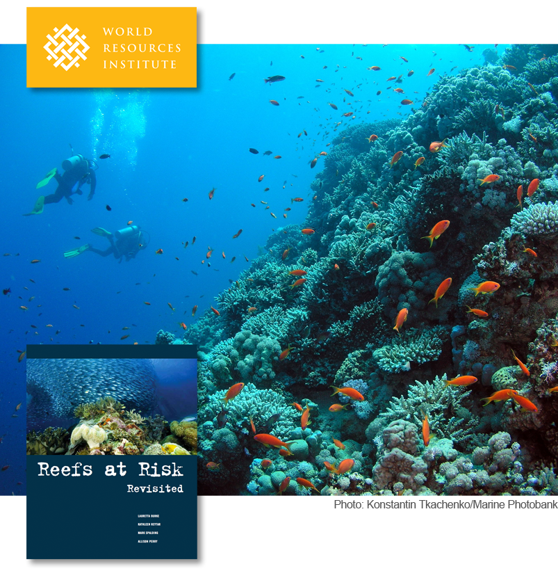
Coral Reefs at Risk

Coral reefs occupy less than one percent of the Earth’s marine environment, but are home to more than a quarter of all known marine species. Reefs also serve as a buffer against incoming storm surges, protecting local populations. Unfortunately, coastal ecosystems are threatened by human activities including overfishing, agriculture, and urban development.
The World Resources Institute and its partners have assessed the threats to the world’s coral reefs. WRI's Reefs at Risk Revisited report is intended to raise awareness about the location and severity of threats to coral reefs. These results can also catalyze changes in policy and practice that could safeguard coral reefs and the benefits they provide to people for future generations.
Check out the report's maps at http://www.arcgis.com/apps/Compare/storytelling_tabbed/index.html?appid=f537896f8e30481e901938eb049a73a0.

Post source: Joseph Kerski, Education Manager for ESRI

Friday, November 9, 2012


Applications to "Teachers Teaching Teachers GIS (T3G)" institute are due Nov 30, and they have started coming in. If you want to help educators use GIS, please consider applying. We seek 100 people who can help engage educators with ArcGIS Online. For more info, see


Original post by Joseph Kerski, Education Manager for Esri

Monday, August 13, 2012

Tribal GIS

Check out the new book Tribal GIS available now on Esri: http://esripress.esri.com/display/index.cfm?fuseaction=display&websiteID=212&moduleID=0


Joseph Kerski, Education Manager for Esri, summarizes Tribal GIS: Supporting Native American Decision Making below:

"In Tribal GIS: Supporting Native American Decision Making, tribal leaders tell their stories about implementing and using geographic information systems (GIS) to address their unique challenges as sovereign Nations. This book covers applications in natural resources and the environment, transportation, cultural and historical preservation, economic development, health, education, public safety, and agriculture. Showing how tribal governments responsible for the stewardship of their land and resources and the health and well-being of their People use enterprise GIS to make decisions, Tribal GIS supports tribes new to GIS and those with GIS experience.
Folks: Be assured that we included several chapters on education in this book. I think you will find these, and the other 30 + stories in this book, inspiring."


Thursday, May 31, 2012

New eBook on Geography and GIS, Videos on Teaching Geography with ArcGIS Online

Joseph Kerski, Geographer and Education Manager at Esri,  shares the following Geography and GIS resources below:


"(1) A collection of essays entitled “Essays on Geography and GIS, Volume 4”, written by academicians and scientists, including Edelson, Goodchild, Dangermond, Artz, and others, dealing with trends in geography, geospatial matters, and GIS, is now available here:

http://www.esri.com/library/ebooks/essays-on-geography-gis-vol4.pdf

(2) I have created 7 videos (90 minutes of content, total) in a series entitled “Teaching Geography with ArcGIS Online” on the channel

This series began with an idea I had for a workshop I taught at the Geographical Association conference. The first 3 parts deal with “why and how can I teach geography with web-based GIS, specifically, ArcGISOnline” (www.arcgis.com) While they each give practical examples, parts 4 through 7 focus on in-depth examples, including global demographic analysis (birth rate, life expectancy, population change, by country), neighborhood deprivation and poverty, and lack thereof (using the UK as an example), plate tectonics (earthquakes, plates, volcanoes, including how to bring in real-time data into the analysis), and how to bring in your own data (by digitizing features on your computer screen, from the field via GPS and smartphones, adding real-time data, and how to add multimedia (video, photographs, sketches, text) to your maps."