Monday, October 31, 2011

3rd Annual GIS Day Statewide Webcast for Hawaii Schools

To sign up for the 3rd Annual GIS Day Statewide Webcast for Hawaii Schools, please register by November 14, 2011 at www.surveymonkey.com/s/GISDayWebcast2011.


2011 Hawaii GIS Field Day - December 6 at the Bishop Museum

Contact Isla Young at 808-875-2307 or isla@medb.org for more information or to sign up.


Wednesday, October 5, 2011

GIS Career Webinar: Top 5 Skills You Need to be Successful in a GIS Career.

On Tues., Sept. 27, Dr. Joseph Kerski, education manager for Esri, and Dr. Devon Cancilla, dean, business and technology for American Sentinel University discussed the top 5 skills needed for a successful GIS career.

Dr. Cancilla and Dr. Kerski believe that GIS is a "core technology of the 21st century."

Please check out the webinar:

http://www.americansentinel.edu/blog/2011/10/04/top-5-skills-you-need-to-be-successful-in-a-gis-career/

Do you agree?

Friday, September 30, 2011

3 GIS Teaching Resources

Joseph J. Kerski, Ph.D., Education Manager with ESRI, shares the following three resources:


Dr. Kerski advises "...add a faults and geology layer or a cities layer. Zoom in on a few of them and change the base map to a satellite image.  What do they look like up close? What do they have in common? What are the differences?"


Dr. Kerski suggests going into the atlas and creating maps, time series graphs, etc. on 179 indicators covering themes such as poverty, education, economy, and environment. There is also a new printed Atlas of Global Development for sale by www.worldbank.org/publications.

Friday, September 2, 2011

2011 Esri Education User Conference Proceedings

The latest shared GIS resources of EdUC forum members are now online

Wednesday, July 20, 2011

Online Graduate Certificate in Spatial Literacy for Educators

A NEW opportunity for educators from a leading institution that also offers full Masters Programs in GIS and more! Check it out:

www.redlands.edu/spatialliteracy

(877) 299-7547

Thursday, July 7, 2011

"The Cloud!" - Why the Web GIS Revolution is so Exciting


And a sneak peak into the soon-to-be-available capabilities of ArcGIS Online that will allow you to publish and share your own data.


If you could share data online, what would it be?


Thursday, May 19, 2011

Joseph Kerski on Scale!

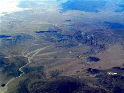
Check out Joseph Kerski's new Video and Blogs on why scale matters in GIS.


Video: Click Here


Joseph Kerski is Education Manager at ESRI - Environmental Systems Research Institute, Inc.


Thursday, May 5, 2011

GPS vs. SmartPhone!


Joseph Kerski, Education Manager with ESRI, conducts two experiments comparing the accuracy of the horizontal position of a SmartPhone vs. that of a GPS receiver. His results show that while the SmartPhone's data is more current and precise than that of the GPS, the GPS's data is far more accurate.

To learn more about Kerski's experiments, please click on the following links:
Comparing a GPS vs. SmartPhone, Part 1 of 2
Comparing a GPS vs. SmartPhone, Part 2 of 2

To learn more about the accuracy of iPhone locations, please click on the following article by Paul Zandbergen, Department of Geography, University of New Mexico:

Zandbergen, Paul A. 2009. Accuracy of iPhone Locations: A Comparison of Assisted GPS, WiFi, and Cellular Positioning. Transactions in GIS, 13(s1): 5-26

Have you used your cell phone for GPS positioning?

Thursday, April 21, 2011

Hawaii Clean Energy Hawaii STEM iPad App


Get the Hawaii Clean Energy Hawaii STEM iPad App Now!
In celebration of EARTH DAY and in honor of teachers, students, and parents worldwide, download the Clean Energy Hawaii STEM iPad App from iTunes on April 22nd!

Download iTunes Now: http://bit.ly/CleanEnergyHawaii


Visit our website: http://www.womenintech.com/


Free only for a limited time

Friday, April 8, 2011

A Place for Everything: Geographic Analysis and Geospatial Tech in Schools

Excellent article by Charlie Fitzpatrick, ESRI Education Manager, now in The Geography Teacher, a publication of the National Council for Geographic Education. The article is available free for reading online or downloading.

How do you encourage students to use geographic analysis and geospatial technology in your school and/or community?

Wednesday, March 16, 2011

Community Remote Sensing


Japan Tragedy: Satellite and Social Media Response Tools Spotlighted

Blog post by Dr. Ray A. Williamson, Executive Director of Secure World Foundation


Wednesday, March 9, 2011

Scholarships Available for undergraduate and postgraduate students interested in Geospatial Data and GIS!


Interested in GEOSPATIAL DATA and GEOGRAPHIC INFORMATION SYSTEM (GIS)? The Hawaii Geographic Information Cooordinating Council is accepting applications until April 5, 2011 for the Mark Lierman Memorial Scholarship Award. Two $1,000 scholarships will be awarded. For more information and download application visit: http://higicc.camp8.org/awards

Wednesday, February 2, 2011

Tuesday, February 1, 2011

Microsoft has selected ArcGIS as a foundation for viewing geospatial information within the DataMarket


"Esri has partnered with Microsoft to offer a set of features that contribute to and enhance the usability of the Windows Azure DataMarket. These features include online applications that query and map geographic data from the DataMarket, online analysis tools and a collection of premium demographic datasets.

Among the data available in the DataMarket, Esri's Updated Demographics (2010/2015) data provides the industry's most accurate population, housing, and income variables.

Windows Azure DataMarket is a cloud service that provides a global marketplace for delivering high quality information in a consistent manner" -http://www.esri.com/software/landing_pages/microsoft/azure.html

For more information, please visit esri.com/azure/datamarket.