Wednesday, November 20, 2013

Happy GIS Day

Happy GIS Day from Women in Technology's GeoTech Hawaii!

GIS Day provides an international forum for users of geographic information systems (GIS) technology to demonstrate real-world applications that are making a difference in our society.
The first formal GIS Day took place in 1999. Esri president and co-founder Jack Dangermond credits Ralph Nader with being the person who inspired the creation of GIS Day. He considered GIS Day a good initiative for people to learn about geography and the uses of GIS. He wanted GIS Day to be a grassroots effort and open to everyone to participate. 
Check out http://www.gisday.com/ for events, activities, and resources! 

Tuesday, November 19, 2013

It's Geography Awareness Week!

Celebrate Geography and The New Age of Exploration this year from November 17th through the 23rd in 2013. Celebrated in conjunction with the National Geographic Society’s 125th Birthday the week's theme focuses on how geography enables us all to be intrepid explorers in our own way. Check out the newly created archive of past Geography Awareness Week materials, a new suite of resources all about Geography as a field and discipline, and even more tips and tools to plan your own GeoWeek celebrations!

Read more about the history and purpose behind Geography Awareness Week. 

Looking for even more resources? Check out the Geography Awareness Week Archive for material dating back all the way to 2000!

Maui Economic Development Board's Women in Technology Project kicked off Geography Awareness Week a little early. They hosted a GIS and Geography celebration event at Queen Kaahumanu Center in Kahului, Hawaii this past Saturday, November 16. Both children and adults had a wonderful time checking out National Geographic's Giant Traveling Map of the Pacific Ocean, doing fun GIS activities, and meeting local geotech professionals. 


Wednesday, November 13, 2013

GIS Day is November 20!

GIS Day provides an international forum for users of geographic information systems (GIS) technology to demonstrate real-world applications that are making a difference in our society.

Wednesday, November 20 is the official GIS Day this year, but the Women in Technology Project will be hosting its own GIS celebration event this Saturday, November 16, from 10 AM - 2 PM at Queen Kaahumanu Center in Kahului, Maui. Free and open to the public, the event will feature the National Geographic Giant Traveling Map of the Pacific Ocean, which is a great interactive learning tool for kids. Local GIS professionals will also be exhibiting at the event. Come join us! 

http://www.gisday.com/


Wednesday, November 6, 2013

Two Important Deadlines!

Esri Education Conference presentation proposals deadline has been extended to Fri Nov 15.
Think about a presentation or a Lightning Talk!

Esri Teachers Teaching Teachers GIS (T3G) Institute application deadline is fixed at Mon Nov 25.
This is a week of intense PD for people who can boost the impact of the license in your state. Look for educators AND education influencers.


Original post by Charlie Fitzpatrick, Esri Schools Program Manager 

Tuesday, October 22, 2013

Esri Education GIS Conference – Proposals Due Nov 1

From the Esri Education Team:

Seems crazy to think about next summer when classes have barely started, but believe it or not it’s time to think about presenting at the 2014 Esri Education GIS Conference. The conference, with the theme “Education’s Grand Challenges-GIS Opportunities,” will explore the big issues currently confronting K-12 schools, higher education, and informal education and the relevance of GIS to those challenges.
Details and submission form: http://esriurl.com/EducCFP
Deadline for submissions: November 1, 2013
Suggested Topics
Education’s Grand Challenges
  • Impacts of the Common Core and other standards
  • The uncertain future of higher education
  • Assessment, badging, and alternative credentialing schemes
  • Online learning and the object formerly known as “textbook”
  • Equitable access and affordability
GIS Opportunities
  • Relevance of GIS to new education standards
  • GIS massive open online courses (MOOC) and online programs
  • What works in teacher professional development
  • Successes and challenges in adopting ArcGIS Online
  • Assessing core competencies in GIS
  • Increasing operational efficiency with GIS
The Esri Education GIS Conference will be July 12-15, 2014 in San Diego, CA.  For more information, see www.esri.com/educ

Mapping the Environment: 10 Resources


Esri Education Manager Joseph Kerski and his colleague Tom Baker recently met with environmental educators at the North American Association for Environmental Education annual conference.  Messages there through the Esri exhibit included:


1.  Map your nature center, school campus, or university’s facilities with ArcGIS.  It can make your center or campus run more efficiently, provide a safer environment, and save energy.
2.  Map and analyze your field data with ArcGIS Online.  It is easy to do, and your students can map anything from invasive species to litter to tree species to water quality, and more.  Use smartphones, GPS, probes, or other methods to gather data and locations of that data for easy input to ArcGIS Online.
3.  Analyze local to global environmental phenomena around the world with these same tools.  For example, you can compare population density to ecoregions to determine which ecoregions are most at risk from human impact.
4.  Dig deeper into further analysis with ArcGIS Online for Organizations and ArcGIS Desktop.  For example, you can determine answers to questions such as “how many water wells are within 500 meters of the riparian zone?”
5.  Tap into your K-12 statewide license or your university license for Esri technology.  Your state’s schools, your school district, or your university may already have a license, just waiting for you to use it!
6.   Connect with other educators using geotechnologies, receive training, discover lessons and data, and more, via the Esri GIS in Education Community.
7.  Use Story Maps to communicate your environmental story.  Esri showed this new Story Map for points of interest in the city of Baltimore for the conference attendees field excursions, for example, cityview.baltimorecity.gov/shortlist/, but others exist here on environmetal themes.
8.  Show students how valuable they become as environmental scientists with GIS skills on their toolbelts by investigating some projects that use GIS and by watching some videos.
9.  Access STEM Connections to GIS on the Esri Education Community site, including case studies, activities, maps, links to standards, and more.
10.  For additional connections between environmental education and GIS, access a Spatial Environmental Education article in Earthzine that Kerski authored, that focuses on Teaching and learning about the environment from a spatial framework.
What can you do to teach and learn about the environment with the above resources?
Original post by Esri Education Manager Joseph Kerski 

Wednesday, October 16, 2013

Earth Science Week October 13-19, 2013!


October 13-19 2013 is Earth Science Week, http://www.earthsciweek.org. "Mapping Our World" is this year's ESW theme, and, again, is a huge opportunity to promote geospatial tech. Before the shutdown, Esri helped folks at NASA create a nice poster http://climate.nasa.gov/esw2013. Esri's resources (including "Mapping Our World") are available at http://edcommunity.esri.com/esw.

Original post by Charlie Fitzpatrick, Esri Schools Program Manager

Wednesday, August 14, 2013

5 Week Spatial Thinking and Web Mapping Course Begins Soon


Esri Education Manager Joseph Kerski will be teaching "Isn't That Spatial? Analyzing Our World Using Digital Maps and Spatial Thinking," a level 1 mapping course beginning next month and running 5 weeks.  It is entirely online and uses web-based GIS tools, 90% of which are ArcGIS Online. 
 
"Join us for a 5 week immersion in the foundations of thinking spatially and applying the foundations to real-world issues and problem-based learning through skill building in web mapping technologies. Issues addressed include landscape and population change, natural hazards, climate, mapping your own field data, and more."
 
The course includes active discussions, hands-on activities, networking, self-assessments, and the development of your plan to implement these foundations and skills.
 
The course begins on September 25 and is $85. If you have any questions, please contact Carolyn Gardner at carolyngardner@enetcolorado.org or Jane Brown at janebrown@enetcolorado.org.

Course link to sign up: http://www.enetcolorado.org/register-for-courses/isnt-that-spatial-analyzing-our-world-through-digital-maps-and-spatial-thinking-course-level-1-starts-september-25th/.

Monday, July 22, 2013

New Spatial Mathematics Book Published

Esri Education Manager Joseph Kerski has co-authored a new book titled Spatial Mathematics: Theory and Practice through Mapping. Spatial mathematics and analysis, two different approaches to scholarship, yield different results and employ different tools. This book explores both approaches to looking at real world issues that have mathematics as a critical, but often unseen, component. Readers learn the mathematics required to consider the broad problem at hand, rather than learning mathematics according to the determination of a (perhaps) artificial curriculum. This format motivates readers to explore diverse realms in the worlds for geography and mathematics in their interfaces.

A video description of the book is available here:
 
You can buy the book at http://www.crcpress.com/product/isbn/9781466505322. Use the code GQM05 when proceeding to checkout for a 20% discount.

Wednesday, June 19, 2013

Investigating Your Community Using GIS

 By Joseph Kerski, Ph.D.
Education Manager, Esri

sterling agol swipe

People have always been fascinated with investigating their home — the Earth.
For centuries, maps have stirred imaginations and inspired explorations of the unknown. Today, maps are used to help understand relationships across time and space in communities. These relationships are analyzed using digital maps within a Geographic Information Systems (GIS) framework.

These maps are dynamic:  They can be customized, saved, and shared online. They use real-time data from community traffic counts or power use. They can be used to analyze issues from local to global scale, from mapping and analyzing population characteristics in my own community to the interaction of global ecoregions, ocean currents, and climate.

In education, GIS offers a powerful decision-making toolkit that can be used in administration, educational policy, and in instruction.

GIS offers administrators a way to monitor campus safety, map  campus infrastructure, route school buses, and target recruitment. GIS provides educational policymakers to see patterns in educational achievement and where to create new programs. In instruction, GIS helps students to understand content from geography to history, mathematics, language arts, environmental studies, chemistry, biology, civics, and others.

GIS is an inquiry-driven, problem-solving, standards-based set of tasks that provides career pathways increasingly in demand, even in their own community. It helps students think critically, use real data, and connects them to local issues. It does so in informal, primary, secondary, and university settings and appeals to today’s visual learners. Geotechnologies, along with biotechnologies and nanotechnologies, are the three key skills and job markets identified by the U.S. Department of Labor for the 21st Century (Virginia Gewin,  “Mapping opportunities,”  Nature, January 2004).

neighborhoods with ArcGIS online

GIS incorporates and depends upon fieldwork, which is critically needed for understanding and appreciating my own community (Richard Louv, Last Child in the Woods. Alqonquin Books, 2005). Students can gather locations with GPS receivers or smartphones along with information about tree species, historical buildings, water quality, and other variables in their community or on their own school or university campus.

GIS-based questions begin with the “whys of where” — how do neighborhoods grow and change? How does a cement plant affect water quality? How is my community affected by nearby and far away interconnections and networks?

After asking geographic questions, students acquire geographic resources and collect data.  They analyze geographic data and discover relationships across time and space.

Investigations are often value-laden and involve critical thinking skills. GIS helps students to act on their investigations, to put recommendations in place, to improve the quality of lives of people. What are the pros and cons and the best route for a light rail line, or the location of a community garden or new library in my community?

Students present the results of their investigations using GIS and multimedia to their class, the school board, or the city council. They can create multimedia web maps and story maps. These investigations usually spark additional questions, and the resulting cycle is the essence of geographic inquiry.

They learn about civic engagement.

Be Spatially Critical

 By Joseph Kerski on     
                                              
At the last Esri International User Conference, my Esri education colleague Laura Bowden and I conducted a spatial thinking workshop.  Laura said something in the workshop that I have been musing about ever since: “Be spatially critical.” This phrase is laden with meaning and examining it in this blog may shed light on why this community believes so firmly in the value of research and practice in GIS in education.
 
Be Spatially Critical

Be Spatially Critical !
 
Effectively using GIS in teaching and learning hinges upon critical thinking and spatial thinking.  For example, some critical thinking questions relate to the context of a problem:  What background research do I need to examine and what content do I need to immerse myself in to be knowledgeable about the issue?  What are the costs and benefits of the issue I am analyzing?  Who are the stakeholders affected by the issue?  What are the historical, current, and future implications surrounding the issue?
 
At the 1987 conference on Critical Thinking and Education Reform, Scriven and Paul stated that critical thinking means to “conceptualize, apply, analyze, synthesize and/or evaluate information gathered from, or generalized by, observation, experience, reflection, reasoning or communication, as a guide to belief or action [or argument].”  GIS can be used to foster such actions, and in practice, this is where critical and spatial thinking meet: What data do I need to gather and analyze to assess the issue completely and accurately?  How can I represent that issue within a GIS environment using raster and vector data sets, multimedia, graphs and charts, and by other means and tools?  Can I trust my data sources?  At what scale do I need to examine my chosen issue?  What data will support that scale of analysis?  What symbology, classification, and presentation techniques should I choose to effectively communicate my results?
 
Other questions are specific to an instructional environment:  As an instructor, how can I best teach to encourage students to be spatially critical?  As a student, what content knowledge, skills, and geographic perspectives do I need to cultivate in order to develop my ability to become spatially critical?
 
In sum, the phrase “Be Spatially Critical” includes elements of critical thinking and spatial thinking, both of which my colleagues and I frequently write about in this blog.  Laura Bowden and I plan to conduct a spatial thinking workshop at the 2013 Esri User Conference as well, and we look forward to reading your comments here and interacting with you during the workshop!
 
- See more at: http://blogs.esri.com/esri/gisedcom/2013/05/31/be-spatially-critical/#sthash.Ao4bMnsk.dpuf

Friday, May 3, 2013

Some GeoTech Updates: Data Quality, and the Geospatial MOOC


(1) ESRI Education Manager Joseph Kerski wrote a short essay on data quality that can serve as a useful tool for discussions in class and in your workshops:
 
Is your data "CRAAP?" A schema to evaluate information-- Currency, Relevance, Authority, Accuracy, and Purpose:  

 
(2) Reminder: The upcoming free Penn State geospatial MOOC (Massively Open Online Course) might be just the thing to nudge your colleagues into making web maps and into spatial thinking:
 
http://blogs.esri.com/esri/gisedcom/2013/04/25/mooc-maps-and-the-geospatial-revolution/

Tuesday, April 23, 2013

4 Online Opportunit​ies to Learn About Spatial Thinking - Web Mapping

Aloha All:

There are several upcoming online, fun, engaging, challenging, and relevant opportunities to learn more about web-based mapping, including ArcGIS Online and other tools, and how to teach and learn about spatial thinking and geotechnologies.  We will have plenty geography, business-related, earth and environmental science content in here – plate tectonics, ecoregions, watersheds, business site location, population change, land use, coastal erosion, climate, and more.  While not necessarily for those of you with years of experience in GIS and GIScience, perhaps telling your colleagues who you have been wanting to dip a toe into the geospatial waters about these opportunities would be a great first step for them.

(1)  Isn’t That Spatial:  Introduction to Spatial Thinking: http://www.enetcolorado.org

 Join us for a 5 week immersion in the foundations of thinking spatially and applying the foundations to real-world issues and problem based learning through skill building in web mapping technologies.   Issues addressed include landscape and population change, natural hazards, climate, mapping your own field data, and more.  The course includes active discussions, hands-on activities, networking, self-assessments, and the development of your plan to implement these foundations and skills.  I am teaching this course and it runs 20 March – 30 April.

 (2)  Investigations in Spatial Thinking: http://www.enetcolorado.org

 Dig deeper with investigations in spatial thinking.  This 5 week course builds on the first spatial thinking course and makes use of today’s easy-to-use but powerful web mapping technologies.  You will build a project including your own web map for use in teaching and learning, as well as investigate topics in human settlement, ecoregions, and others from local to global scale.  I am teaching this course and it runs 20 March – 30 April 2013.

 (3)  Online Course:  Maps and the Geospatial Revolution!: https://www.coursera.org/course/maps

Learn how advances in geospatial technology and analytical methods have changed how we do everything, and discover how to make maps and analyze geographic patterns using the latest tools.   This is a MOOC (Massively Open Online Course) through Penn State University, instructor is Dr Anthony Robinson.   It is 5 weeks long and begins on 17 July 2013.

(4)  As a reminder, a 3-hour online  course that was developed by our colleague here at Esri that is freely available online at ANY TIME is entitled “Teaching with GIS: Introduction to using GIS in the classroom” and is available through the Esri campus: http://esriurl.com/vcteachingwithgis

 These opportunities are listed, along with other events, on the GIS education community calendar on the right side of http://edcommunity.esri.com

 Original post by Joseph Kerski, Education Manager for Esri

Wednesday, March 6, 2013

MOOC Maps and Geotech Course Available!


ESRI Education Manager Joseph Kerski has been working with Penn State to develop the first ever MOOC (Massively Open Online Course) in mapping and geotechnology! If you would like to join in, it starts on 17 July 2013 and is 5 weeks long:
Register for the course on: https://www.coursera.org/#course/maps 


Thursday, February 21, 2013

Understanding the Digital Generation


Ian Jukes recently authored a book titled Understanding the Digital Generation, which "explores the fundamental characteristics of the children in this new digital generation." This book is a great read for educators and parents alike to better understand the digital world our young people live in, and how to best enhance their learning abilities and experiences. More information on the book can be accessed here: http://store.fluency21.com/collections/all/products/understanding-the-digital-generation.

The most frequently asked questions about Jukes' work can be found here:
http://fluency21.com/blog/2013/02/19/ask-ian/

Original post by ESRI Education Manager Joseph Kerski

Wednesday, February 6, 2013

The Importance of Being Critical of Map Data, Even it is Your Own...

http://spatialreserves.wordpress.com/2013/02/03/be-critical-of-data-even-if-it-is-your-own/

This simple example points to the serious concern about the consequences of using data without being critical of its source, spatial accuracy, precision, lineage, date, collection scale, methods of collection, and other considerations. Be critical of the data, even when it is your own!

Source: Joseph Kerski, Education Manager for ESRI

Monday, February 4, 2013

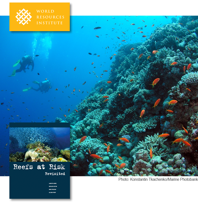
Coral Reefs at Risk

Coral reefs occupy less than one percent of the Earth’s marine environment, but are home to more than a quarter of all known marine species. Reefs also serve as a buffer against incoming storm surges, protecting local populations. Unfortunately, coastal ecosystems are threatened by human activities including overfishing, agriculture, and urban development.
The World Resources Institute and its partners have assessed the threats to the world’s coral reefs. WRI's Reefs at Risk Revisited report is intended to raise awareness about the location and severity of threats to coral reefs. These results can also catalyze changes in policy and practice that could safeguard coral reefs and the benefits they provide to people for future generations.
Check out the report's maps at http://www.arcgis.com/apps/Compare/storytelling_tabbed/index.html?appid=f537896f8e30481e901938eb049a73a0.

Post source: Joseph Kerski, Education Manager for ESRI